By Barbara Gibbs Ostmann
All photos courtesy Switzerland Tourist Board
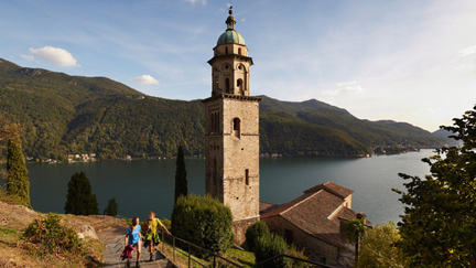
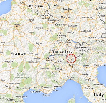
Switzerland is celebrating 150 years of Alpinism this year, and there’s no better way to celebrate than by going for a long mountain hike.
Aristocratic English adventurers were on to a good thing back in 1857 when they reached the summit of the Finsteraarhorn and later, upon their return to London, founded The Alpine Club, the first mountaineering association in the world.
By 1863, English climbers had ascended more than 50 Swiss peaks, firmly launching Switzerland as the playground of Europe and the center of mountain tourism. Today’s hikers can choose from more than 40,000 miles of well-marked paths throughout the country.
NEED COMFORTABLE BOOTS
Touring Switzerland by foot is a lot different than touring it by train or car, and worth all the sweat and effort. The key to a successful hiking trip is a pair of well-broken-in hiking boots — it is not the time to try out a new pair.
Having lived in Switzerland for two years as a graduate student, and visiting it many times, I had my doubts about going on an organized hiking tour. But hiking in a group proved to be a great way to visit Switzerland, providing moral support and camaraderie. Although we had prepared for the trip by hiking at home, we all benefited from the well-planned itinerary that began with easy walks and built up to the steeper climbs, preparing us physically for the more difficult parts of the hike.
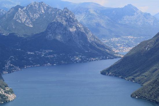
My group of hiking companions, ranging in age from 13 to 67, set off in high spirits from Les Avants, above Montreux on Lake Geneva in the French-speaking part of Switzerland, and arrived 10 days later, foot weary but fulfilled, in M̹rren in the heart of the Bernese Oberland in German-speaking Switzerland.
STARTED EASY
The adventure began with an easy hike through the forest up to the Col de Jaman (Jaman Pass), above Lac Leman (Lake Geneva). We spent the first night on the trail in a matratzenlager or dormitory — a large room filled with side-by-side mattresses. It was a good introduction to what to expect in the final stages of our hike when we would be in the mountains for three days, carrying all our food and clothing. For most of the trip, we carried a day pack and a sack lunch each day, while our suitcases were transported by bus to the next village and hotel where we would spent the night.
It was early to bed because it was early to rise. At a little more than 11 miles, the next day’s walk was the longest of the trip, and much of it was on paved roads— hard on the feet and legs. However, the scenery along the Lac de L’Hongrin was beautiful and the weather was sunny and warm. The day’s hike ended in L’Etivaz, a small village in the French part of Switzerland.
DAY THREE
The third day’s walk was more typical of those to come. We started with a steep climb out of the valley and up to the windy Col de Jable (Jable Pass), where we huddled behind a rock fence to eat lunch. Upon crossing the Col de Jable, we left the French Canton of Vaud and entered the German Canton of Bern. Descending, we arrived in the glitzy resort town of Gstaad. There was time to shop, but in our hiking gear, we didn’t look the part of fashionable Gstaad jet-setters.
In the morning, we hiked through drizzling rain to the bus stop and took the postal bus from Gstaad to the village of Lauenen, where we set out on the day’s hike. As we trudged over the Tr̹tlisberg Pass, the rain grew heavier and the temperature dropped. At the top of the pass, it was sleeting, and we were wet, cold and miserable. No stop for a picnic lunch at the top of this pass! In fact, no stop for lunch at all. All we wanted was to get to the next town, Lenk, and get warm and dry.
We did hole up briefly on the porch of an unoccupied chalet where we nibbled chocolate bars, changed from wet to dry clothes (if you were lucky enough to have any dry ones in your pack) and generally fortified ourselves for the remaining descent. We finally arrived at our small hotel in Lenk, where we rushed to get into hot baths midpoint of hike the hotel quickly ran out of hot water.
The next day, the midpoint of the hike and a free day, dawned sunny and bright. Many of us took the ski lift up to Leiterli from where we could see across the valley to the pass we had crossed the day before in the rain. We could pick out the chalet where we stopped, the place where we got lost and had to climb on our hands and knees on the slippery scree to get back up to the path, and where we had turned off to take a shortcut to town. It looked better in the sunshine than it had in the rain the day before!
Sunday, it was back to the trail. We started with a short bus ride to the hamlet of B̹elberg, from which we hiked to the Hahnenmoos Pass. It was drizzling, but nothing like the rainy day we’d had before. As we descended, the rain stopped, and we arrived in the lovely town of Adelboden with time to visit the shops.
The journey from Les Avants to Adelboden had been an introduction to the days to come. From Adelboden on, the mountains were higher and more rugged, and much of the trail was above the timberline.
The next day’s 9-mile hike began with a long, hard climb up to the Bunderchrinde Pass — more than 3,500 feet over slippery shale rock — then on to Kandersteg. As I sweated, puffed and panted, I wondered if I could actually make it. But when I reached the pass at 7,500 feet, it was more than worth the effort.
In my notebook I wrote, with words inadequate to describe the satisfaction of being there: What a thrill. The view is worth the whole hike. We are above the clouds, and in the clouds, as they move and change position. The north face of the Eiger just popped out of the clouds — thrilling! Eiger and Munch
Later, both the Eiger and the M̦nch were stunning as they poked through the clouds. Sighting the Eiger that day was the first of many such glimpses as we continued toward it and ended up directly across from it at our final destination of M̹rren. We were now at the heart of the hike — three days in the mountains with everything on our backs, hiking from Kandersteg to M̹rren, across the Bernese Oberland into the shadow of the Jungfrau, the magnificent mountain and glacier above Interlaken.
Luck was with us, and we had great weather for the three days, and even the next day in M̹rren, when we visited the Jungfraujoch in bright sunlight.
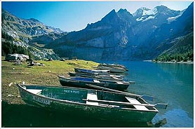
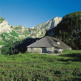
Leaving Kandersteg and its comforts, we started with a chairlift up to the Oeschinnensee, a spectacular Alpine lake with blue waters in an incredibly beautiful setting. From the lake, it’s a climb of more than 3,600 feet to the Hoht̹rli Pass, where we spent the night in an Alpine hut on the Bl̹misalp, next to a glacier. The hut, perched precariously on the top of the pass, is a popular spot for summer hikers and mountain climbers. In the winter, it is covered completely by snow. The accommodations at the hut consisted of a large room filled with mattresses, where we all piled in and slept like logs.
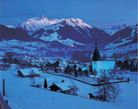
COLORFUL, AWESOME SUNSET
One of the thrills that day was watching the colorful sunset, as the sun sank into the clouds, framed by the mountain peaks. From the pass, we could pick out the Eiger, now bigger and closer than its first sighting yesterday, as well as the Schilthorn with its restaurant perched on top, the scene of the James Bond movie, “In Her Majesty’s Secret Service.”
We began the morning’s descent by clinging to a steel cable pegged into the mountain wall as we slipped and slid on loose scree. The descent of 4,000 feet before reaching Alpine pastures seemed interminable. We just kept walking-and walking-and walking and going down and down and down.
We finally reached the valley floor where a glacial river flowed, icy cold and steel gray in color. We peeled off as much clothing as we could and still be decent and cooled off in the stream. Then it was on to a nearby chalet for cold beer and our sack lunches.
In the afternoon, we hiked along a wide path with wildflowers and bright sun. It was a delightful walk, leading us to our accommodations for the night: a cow and goat barn at Unter D̹rrenberg.
A ‘LOFTY’ SLEEP
We climbed a ladder from the stables to the loft. (You quickly learn to hold the sides of the ladder, not the rungs, unless you want a handful of cow manure!) In the loft, there were side-by-side mattresses, as in the dormitories. Only here, the air was scented with ammonia from the goats and cows below. It was primitive, but one of the trip’s highlights for me, but not for some of my fellow hikers. It was probably a good thing that the next night we would find ourselves in a comfortable hotel once again.
The next day was the last day of the hike, and we hated to see it end. The morning’s climb was the most difficult of the entire trip — or maybe I was just getting tired. I thought I’d never make it across all that slippery scree and obtain the summit. But once again, upon arriving at the pass, the Sefinenfurke, the views were so spectacular and the feeling of accomplishment so great that I immediately forgot the ordeal of arriving there.

MAKE IT LAST
We dawdled over lunch at the pass; everyone wanted to make the day last as long as possible. A snooze in the sun, a scramble to a nearby peak for photos, and soon it was time to descend. We crossed from the shale into Alpine pastures into forest and down into M̹rren, a picturesque village perched on the side of the mountain, facing the Jungfrau, M̦nch and Eiger across the valley.
The snow-covered mountains radiated sunlight as we descended, alpenstocks (walking sticks) in hand. After watching the Eiger grow larger and larger for several days, suddenly there it was, bigger than life and bathed in bright sunlight.
The feelings of the group could be summed up in the words we saw carved in German on an ancient chalet in the village of Kandersteg:
“He who drinks of the high mountain light, shall know no unhappiness on earth.”
I’ll drink to that.
ET EXTRA
The company I traveled with is no longer offering the Swiss hiking itinerary, but several other companies offer similar guided or self-guided trips. Start with these links and do some research to find the trip that suits you.
* Ryder Walker Alpine Adventures, www.ryderwalker.com.
* Wanderweg Holidays, www.wanderwegholidays.com.
* Active Journeys, www.activejourneys.com.
* Ibex Treks, www.ibextreks.com.
* European Walking Tours, www.walkingtours.com.
* The Wayfarers, www.thewayfarers.com.
* Alpinehikers, www.alpinehikers.com.
For hiking tips and itineraries specific to Switzerland, visit www.myswitzerland.com and click on “hiking.”
The most important item for a hiking trip is a good pair of boots that fit you well and are thoroughly broken in. Other things to include in your pack are: moleskin, Band-Aids, Swiss Army knife, water bottle, sunscreen, Ace bandages, medicated powder, poncho, wool or fleece sweater or jacket, flashlight, binoculars, compass, hat, sunglasses, resealable plastic bags for keeping articles dry. Be sure to dress in layers — the weather in the mountains can change swiftly.
ABOUT THE WRITER
Barbara Gibbs Ostmann is an award-winning journalist with 30 years of writing and editing experience in newspapers, magazines, cookbooks and newsletters. She was food writer for the New York Times Regional Newspaper Group from 1993-2005 and food editor of the St. Louis Post-Dispatch from 1975-1990. She joined the faculty of the University of Missouri-Columbia as an assistant professor and the coordinator of the Agricultural Journalism program from 1991-1993.
Barbara has co-edited 12 cookbooks and is co-author of “The Recipe Writer’s Handbook,” a style manual, and was copyedited or contributed to 17 other books. She writes about travel, food and wine for regional and national magazines, and copyedits manuscripts for several publishing houses.
Barbara is treasurer of The Culinary Trust, the philanthropic arm of the International Association of Culinary Professionals (IACP). She is also on the Board of Directors of the Midwest Travel Writers Association and the Missouri Association of Publications. She has traveled extensively in Europe, Asia, Australia, Africa, North America and South America.